- Go out into your schoolyard and look for birds.
- Note the name of the bird and the place you saw it. Put this information into a table. If you can, take pictures of the birds you see.
The following is a map from the ALA of Theodore, ACT. The pin marks the middle of an area with a 5 km radius area around the centre of the suburb. Each dot on this map indicates a mammal sighting.
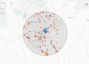
To see how to find a map of your own area, see User Guide 1 – Finding the species recorded in your area.
2.
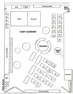
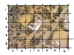
- Draw or print a map of your schoolyard to show the location of your bird sightings. On the map design a key to show where each bird was found.
Or:
- Draw or print a map of your schoolyard to show the location of the bird sightings. With dots to represent bird sightings, use grid references to show which bird was found at each dot.
Some examples of what the maps may look like are shown below:
Links to the Australian Curriculum